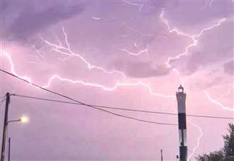
A thunderstorm warning has been issued with forecasters saying almost a month’s worth of rainfall could hit Kent within hours.
Heavy showers and frequent lightning strikes are predicted tomorrow, with up to 35mm of rain falling within an hour and perhaps 60mm battering areas within two hours.

Last year, the UK had an average rainfall of 82.4mm in July, according to the Met Office.
The yellow weather warning comes into force at 10am tomorrow and is in place until 9pm for much of southern England.
Forecasters say storms will tend to become more confined to the south and east of the warning area, meaning Kent, Surrey, Sussex, Essex and London are most likely to be affected, later in the afternoon before dissipating in the evening.
However, the Met Office says while there is potential for a significant impact it has classed the eventuality as having a “very low likelihood”.
“Consider if your location is at risk of flash flooding,” the Met Office states. “If so, consider preparing a flood plan and an emergency flood kit.
“Prepare to protect your property and people from injury. Before gusty winds arrive, check to ensure moveable objects or temporary structures are well-secured.

“Items include bins, garden furniture, trampolines, tents, gazebos, sheds, and fences.
“Give yourself the best chance of avoiding delays by checking road conditions if driving, or bus and train timetables, and amending your travel plans if necessary.
“People cope better with power cuts when they have prepared for them in advance. It’s easy to do; consider gathering torches and batteries, a mobile phone power pack and other essential items.”
